

Catholic Geo
About
Documenting, Mapping, and Creating a Geographic Vision of the Catholic Church
About the Ecclesiastical Jurisdiction Geodata
The Ecclesiastical Jurisdiction datasets show the geographic boundaries of the Catholic Church’s dioceses, ecclesiastical provinces, and episcopal conferences around the world. They represent the Church’s ecclesiastical territories and provide a way to see how the Church is geographically organized across countries and regions.
For centuries, this geography has been documented disjointedly through printed maps, directories, sub-national atlases, and local sources, but it had never been available as a unified global contemporary geographic resource until 2016. These boundaries make it possible to connect the Church’s territorial structure with other geographic and social information, supporting research in theology, canon law, social sciences, technology, environmental studies, and philosophy. The data have been used for mapping, research, pastoral and social analysis, and understanding the Church’s presence in particular places and how to correspondingly live our missions and support ministries there. By bringing this geography into a documented digital form, the repository provides a foundation for research across disciplines and for a more complete understanding of the Catholic Church as a global geographic institution.
History and Development of the Global Ecclesiastical Jurisdictional Boundaries
The development of the Global Ecclesiastical Jurisdictions Repository grew from a simple question: where is the Church? Before this project, information about Catholic dioceses and other ecclesiastical jurisdictions existed scattered across books, statistical publications, local diocesan maps, historical atlases, and digital resources, but there was no unified, global geographic dataset or even unified analog map of the Church’s geographic presence.
Historical resources such as those in the David Rumsey Map Collection and the Atlas Hierarchicus provided important precedents, but their maps were sub-continental without a standardized global projection used or framework suitable for modern analysis. An important precursor was created by Sasha Trubetskoy, who drew Catholic ecclesiastical provinces (Administrative 1) by hand using GIMP, an open-source image editing tool that is similar to Micrsoft Paint or Photoshop. Although these boundaries were not data-driven, missing substantial information, and had a high margin of error, they shared the basic vision of representing the Church’s geographic organization globally. Sasha later joined GoodLands as a member of the original boundary-dataset team. My subsequent research brought together many sources, the ones used for mapping ultimately documented in the Data Provenance databases on this site, to develop a systematic, true-to-scale geographic representation of the Church’s jurisdictions.
In 2016, I was an invited researcher at Esri’s Applications Prototype Lab in Redlands, California, where I served as project lead for the development of the first version of the global ecclesiastical boundaries data and maps. Developing the initial boundaries required working with and regularly consulting a large team that included Esri’s technical, cartographic, and professional-services experts, as well as external researchers, boundary digitization and governance experts, and Catholic data specialists.
Before beginning the project at Esri, I spent well over a year searching for a comprehensive global ecclesiastical jurisdictional dataset, including working with students at the Yale School of the Environment. In June 2016, I sought confirmation from the Holy See’s Office of the Secretary of State as to whether a comprehensive global geographic dataset, or even a unified analog map of Catholic ecclesiastical jurisdictions, already existed internally or was known to exist elsewhere. Those discussions confirmed that the Holy See did not possess such a unified dataset or even analog map and had no knowledge of one existing. I understood that, because geographic boundaries provide a framework for connecting people, institutions, resources, and places, making the Church’s jurisdictions visible as data could reveal the Church’s global presence in ways that had previously been difficult to see or analyze. Knowing this, I then sought and subsequently received permission from the Holy See to proceed with the research at Esri and develop the dataset of Ecclesiastical Jurisdictions.
The project required extensive research and synthesis. I compared jurisdictional maps, diocesan materials, historical documents, Catholic statistical and hierarchical sources, and other geographically descriptive materials to construct boundaries within a common geographic framework. The resulting maps were first presented at the Second Session of the Vatican Arts and Technology Council at Casina Pio IV in December 2016, providing the first unified visualization of the Church’s territorial organization and presence at a global scale.
The 2016 work became the foundation for subsequent versions of the global ecclesiastical boundary dataset and was incorporated into GoodLands, the organization I founded and led, where I continued to develop, correct, enrich, and use the boundaries in geographic research, mapping, and analytical applications. GoodLands is now being wound down as I transition this work into an academic and ecclesial context. The present Global Ecclesiastical Jurisdictions Repository continues that lineage through the Pontifical University of Saint Thomas Aquinas (Angelicum), where I am a doctoral student researching the geography of the Church and developing a foundational treaties in the field, and the Catholic University of America, where I am the inaugural Ignazio Danti, O.P. Fellow in Geography at the Leonum Institute of AI and Emerging Technologies.
My work continues updates and consultation regarding the boundaries with the broader ecclesiasl community and professional collaborators from the geographic sciences and policy and now places greater emphasis on codifying the research developed through these earlier projects, including ontology and knowledge representation, governance, versioning, temporal information integration, and peer-reviewed verification processes. The purpose is not simply to produce a map, but to maintain a documented geographic infrastructure through which the Catholic Church’s territorial organization, people, institutions, and changing global presence can be reliably represented, studied, and used in support of research, missions, and ministries -- critical support for spatial data infrastructure for Catholic communities.
The development of this work has been informed by sustained engagement with international geographic and Catholic communities. I have participated in United Nations Committee of Experts on Global Geospatial Information Management (UN-GGIM) sessions and discussions with United Nations and head geographers and relevant national government officials from various countries concerning geospatial data, governance, and the representation of territories and religious communities. I have also participated as the sole participant from a religious organization in certain UN statistical and geospatial sessions. The work has further been shaped by years of consultation with Catholic communities, dioceses, religious orders, and other ecclesial organizations across different regions, helping me identify local geographic realities and improve the accuracy and usefulness of the data.
Beginning in 2018, official aproval for the establishment of a test-run dedicated institutional home within the Holy See for this geographic work were approved by His Holiness Pope Francis, though the resourcing and arrangements required continued conversations. The institutional framework to support this work in the Holy See remains under consideration, though its future there is uncertain. The project is presently housed in its academic context with the Pontifical University of Saint Thomas Aquinas and The Catholic University of America, also a pontifical university.
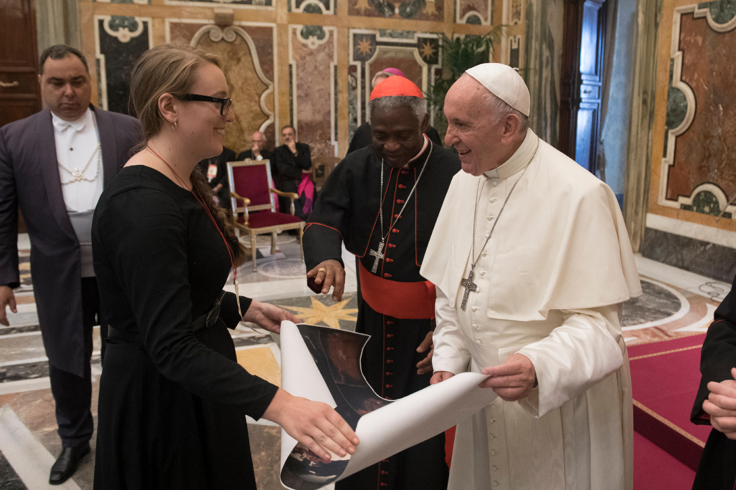
Presenting Pope Francis with a map of Catholic ecclesiastical jurisdictions with the Catholic % of the general population, embellished with the cosmic visions of St. Hildegard von Bingen, with Cardinal Peter Turkson, Vatican City. Photograph by Vatican Media 2018.
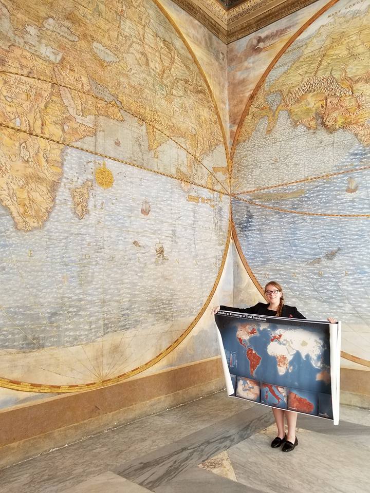
In the Third Loggia of the Apostolic Palace, Vatican City, a picture taken while holding a rolled up map of Catholic ecclesiastical jurisdictions presented during meetings at the Holy See. Photograph by Molly A. Burhans (2017).
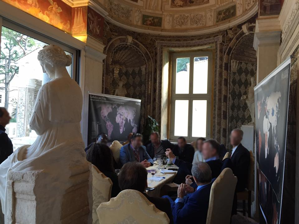
Large-format maps of Catholic ecclesiastical jurisdictions premiered at the Vatican Arts and Technology Council second session, Casina Pio IV, Vatican City. The maps presented a unified global geographic representation of the Church's territorial organization. Photograph by Molly A. Burhans (December 2016).
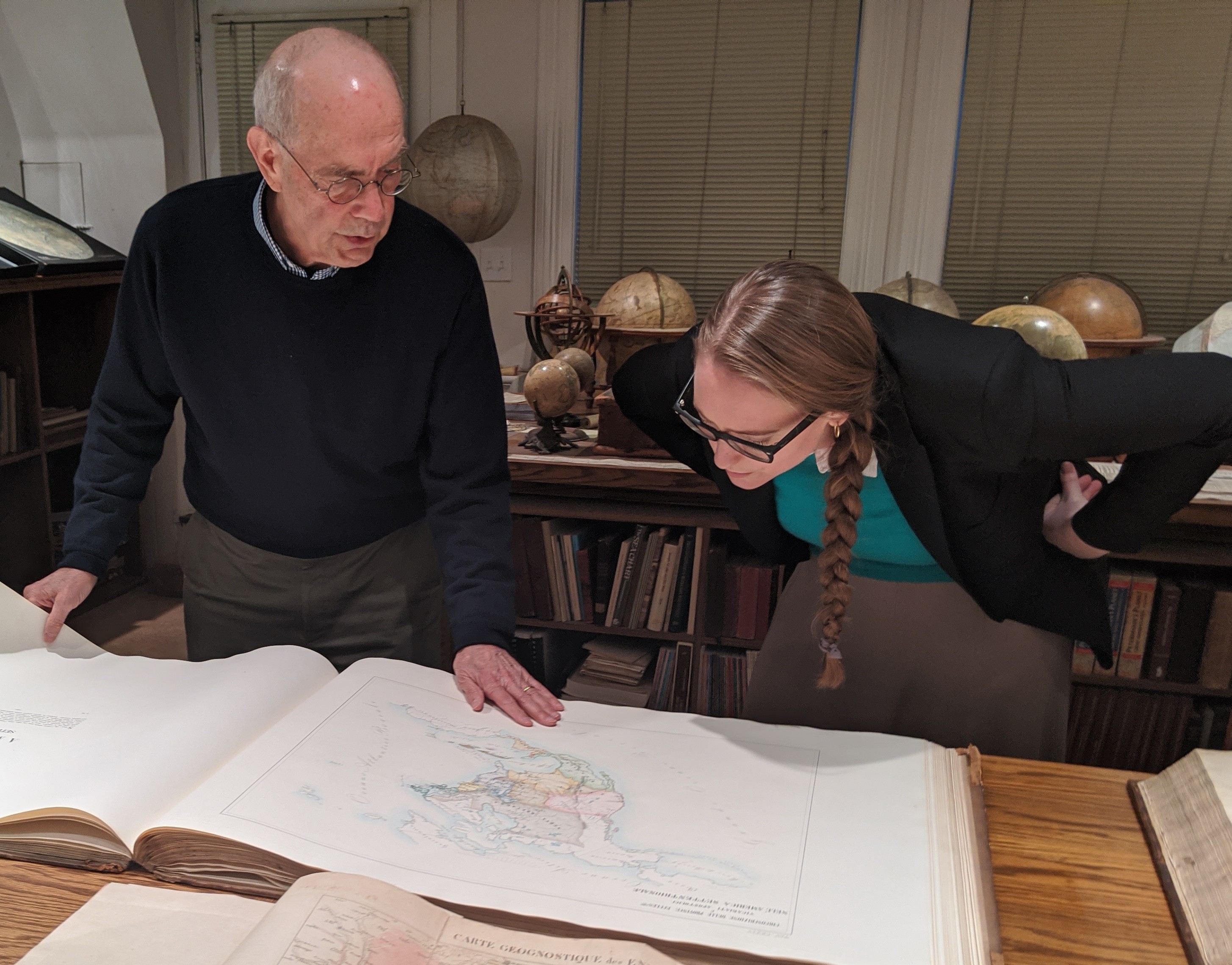
Molly A. Burhans examining an 1858 Atlas of the Catholic Church with David Rumsey from the Stanford University David Rumsey Map Collection. The large-format folio contains detailed historical maps of Catholic dioceses, documenting ecclesiastical geography at limited regional and non-global scales. It provides an important historical precedent for the geographic documentation of ecclesiastical jurisdictions. Photograph by David Owens (2020).

© 2026 Pontifical University of Saint Thomas Aquinas (Angelicum) Faculty of Social Sciences (FASS), and Catholic University of America.
Disclaimer:The Global Ecclesiastical Jurisdiction Data Repository does not necessarily reflect the views, positions, policies, or official determinations of the Pontifical University of Saint Thomas Aquinas (Angelicum/PUST), the Catholic University of America (CUA), the Holy See, Catholic-Hierarchy.org, or any other institution, organization, or source represented or referenced in the repository.
Copyright, Licensing, and Use
The ecclesiastical jurisdictional data and contents of this repository, except when specified otherwise, are licensed under the Creative Commons Attribution–NonCommercial–NoDerivatives 4.0 International License (CC BY-NC-ND 4.0). You are free to share and copy the material for non-commercial ends, provided that due credit is given. Altered, modified, remixed, or transformed forms of the data may not be distributed under this license. This license does not restrict the production or publication of separate non-commercial analytical, cartographic, or research outputs relying on the data, provided that such works do not form an altered or adapted version of the dataset itself and that original sources are properly credited.